
The advantage of having your four wheel drive stolen (August last year) is being able to start again and improve on the earlier model. I bought another Hilux, mainly because my first was such a great vehicle and because they’re so common in rural and remote areas there will always be parts and someone who can fix it if something goes wrong.
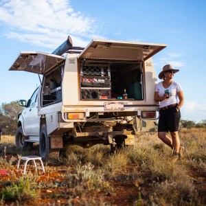
So I designed a canopy set up that met my needs and had it fabricated in Brisbane. My Hilux is my home so I pretty much carry everything I own in it. My canopy design allows lots of easy access to storage and room to sleep if camping conditions outside aren’t ideal. (By the way, my idea of camping is a rolled out swag so I’m pretty low maintenance.)


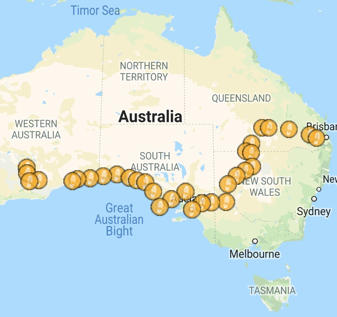
- Brisbane to Kalgoorlie as tracked by my GPS tracker
I left Brisbane on February 21. I had a few weeks to get to Adelaide where I’d lined up a week’s work and then I was heading across the Nullarbor to the West Australian Goldfields.
Travelling alone
My first night was spent at a great free camp at Chinchilla Weir. My second night was spent at a fantastic campsite at Wyandra. Cost was a donation in the donation box. It was here I met an interesting couple that reminded my why I was so lucky to be travelling on my own.
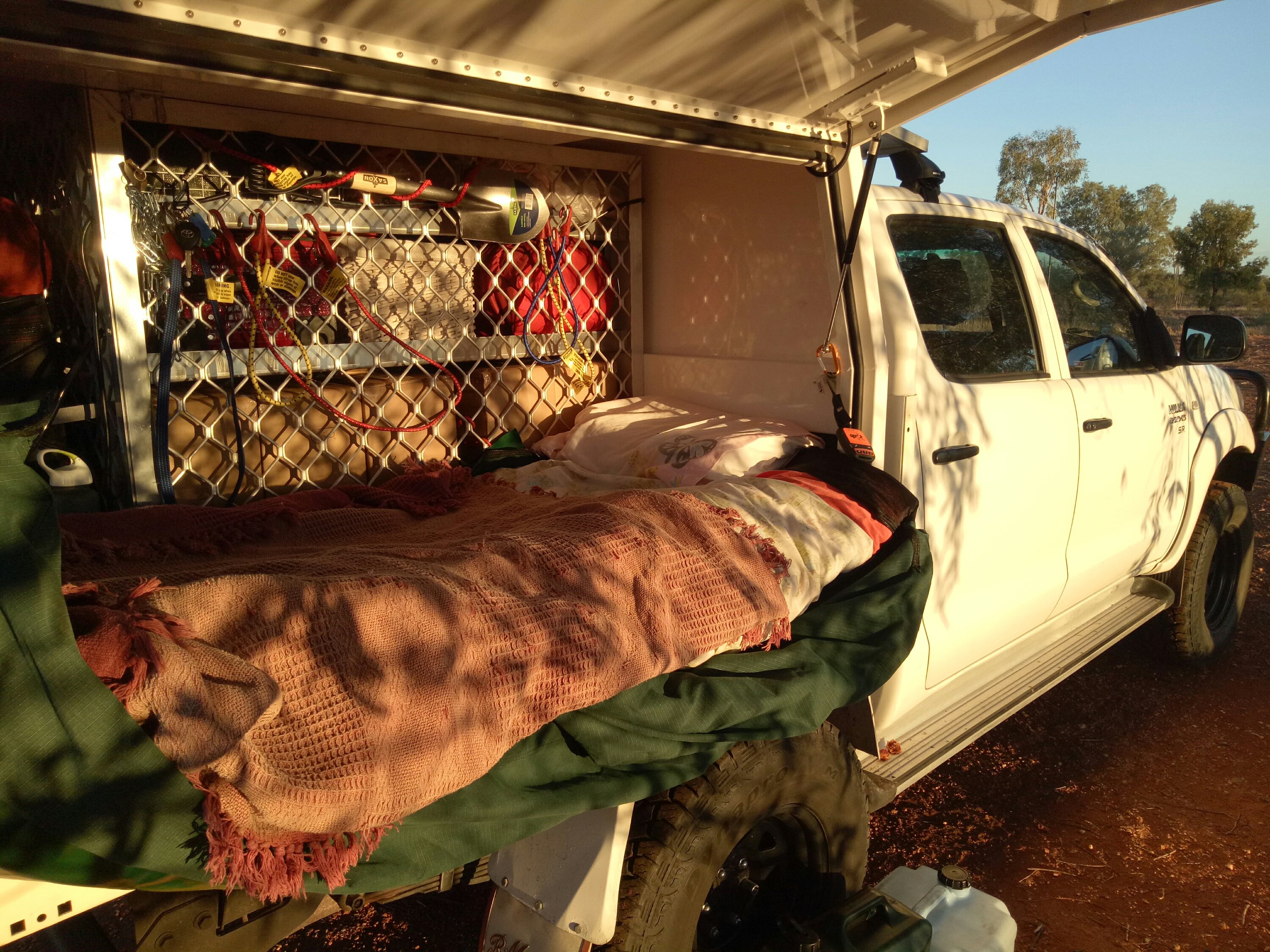
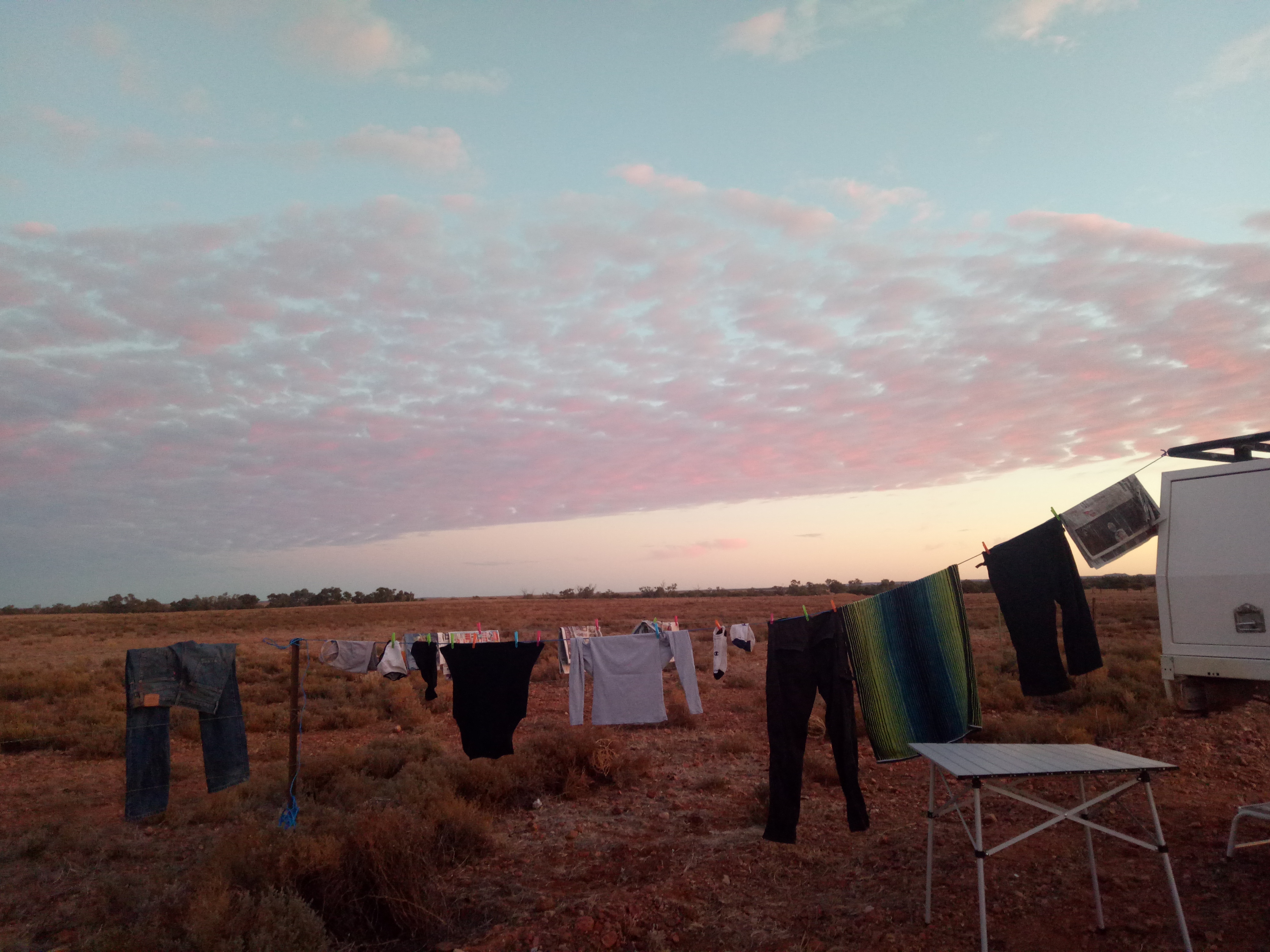
- On occasion I’ll sleep in the back of the Hilux. Most times I’m in my swag on the ground or on my stretcher. I only use a tent when there are others around or when the nights are cold.
The retired lady was a former teacher and absolutely lovely. We were having a wonderful chat when her husband walked into my camp and proceeded to talk all over his wife, ‘mansplain’ to her, talk down to her, discredit anything she said, and generally be a dominant ass.
They eventually returned to their caravan and I raised a glass to travelling solo.
Camping 30km from the closest human
I was so excited to be going back to Currawinya National Park. I’d been there in the early 90s when the Queensland Government had just taken charge of it. Formerly a sheep station, and 830km west of Brisbane, it’s now one of Qld’s biggest national parks and plays a critical role in efforts to save the bilby.
Not worried about snakes and creepy crawlies, I rolled out my swag on the banks of Caiwarro waterhole. Still summer, it was hot, really hot, but that meant wildlife would come to the waterhole to drink.
- My campsite at Currawinya National Park, far western Queensland.
The following day I explored the park in 40+ degrees and moved camp to the Ourimperee Waterhole. Nearby was an amazing open-air shower using bore water that is naturally heated in the black pipes.
When a wrong turn takes you to the place you’re supposed to be; My favourite day of 2018.
Upon leaving Currawinya National Park I crossed the New South Wales border at Hungerford and headed towards Wanaaring on a rocky dirt road. Well, I thought I was. Turns out I missed the turn-off and was unknowingly en route to Bourke. And what an accidental detour it was!

- The border gate at Hungerford, far western Qld. The other side is NSW.
A few hours and 150km later, I stopped at Fords Bridge. I really was at the back of Bourke! There’s not much to Fords Bridge: a pub, an old community hall, and a fire brigade shed. I always stop at remote pubs. Always. That’s where the adventures are! And the Warrego Hotel at Fords Bridge was no exception.

The publican wasn’t in the pub though. He was in the community hall next door and he was having a hell of a time. Peter Thompson is an old fella with limited mobility. He’d had his car stolen by Bourke locals. The vehicle had been recovered but the engine was ‘cooked”. He’d planned to put it into the hall and that’s where he was going to fix it. But the century-old hall floorboards had other ideas. His 4WD had fallen through the floorboards and onto the ground half a metre below.
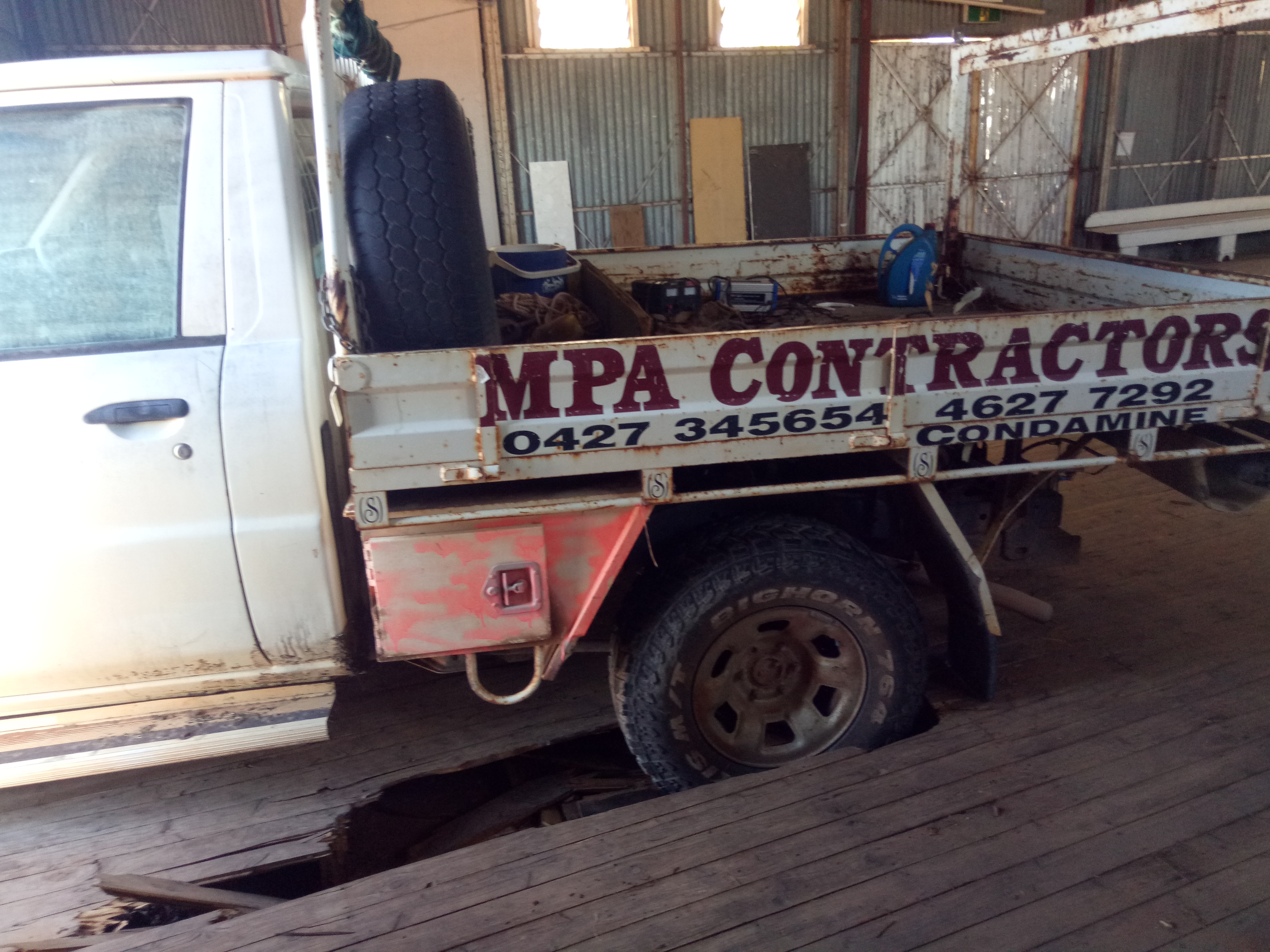
- Oops. The floorboards in the old Warrego Hall at couldn’t hold Peter’s ute.
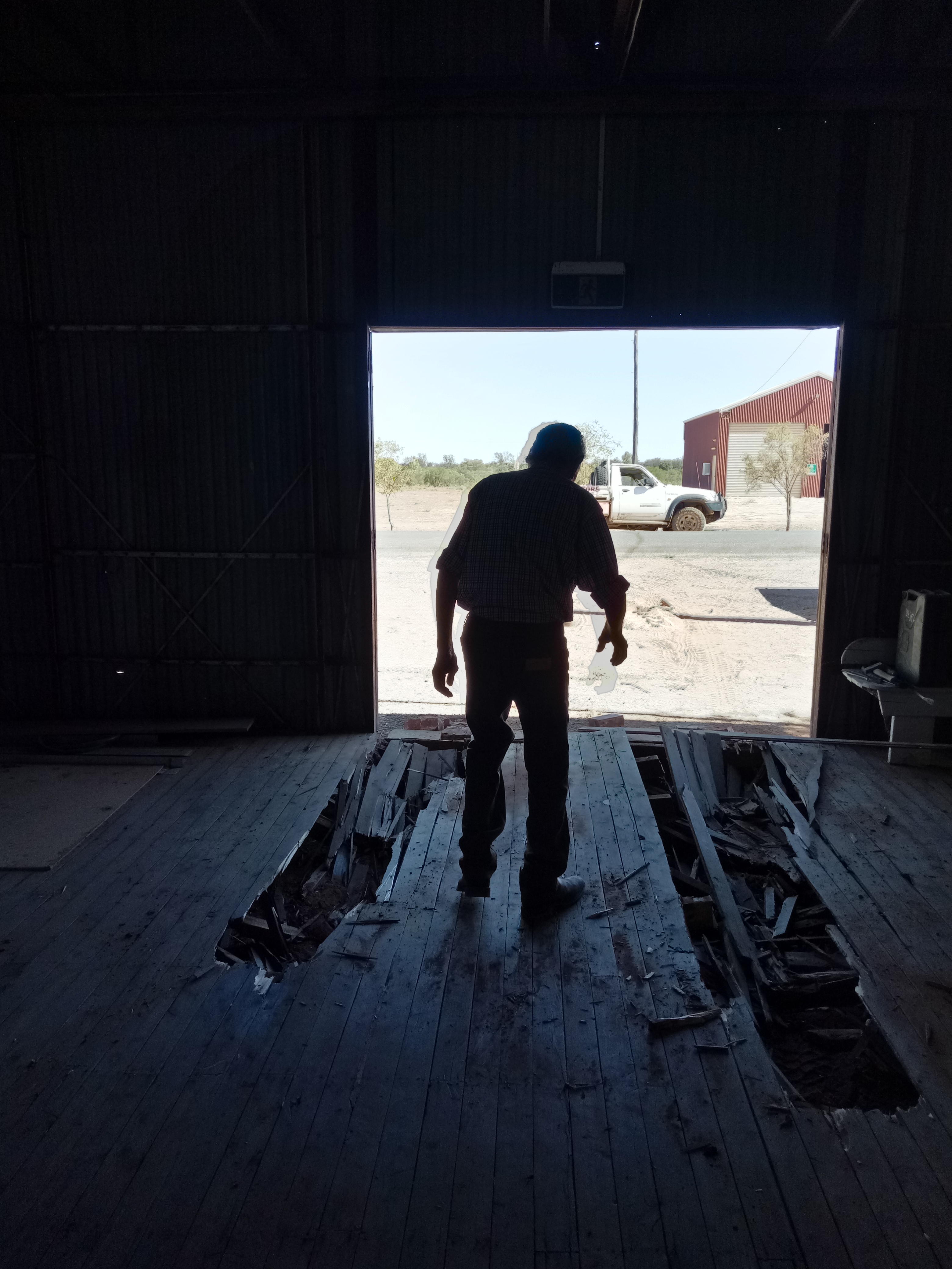
- Peter and the hall had seen better days.
Peter wasn’t giving up, even though his body just about has. He was going to pull the car out with the tractor, then get long planks to cover the holes in the hall floor and have a second attempt at parking the car in the hall.
And that’s where I came in. I’m not sure he knew what hit him. We discussed his plan, fine tuned it, I got bossy and he followed my direction. One of my favourite things to do is problem-solve.
I dragged the planks in place for him, then guided him in, and then laid palings under his tyres to spread the load across a wider surface area.
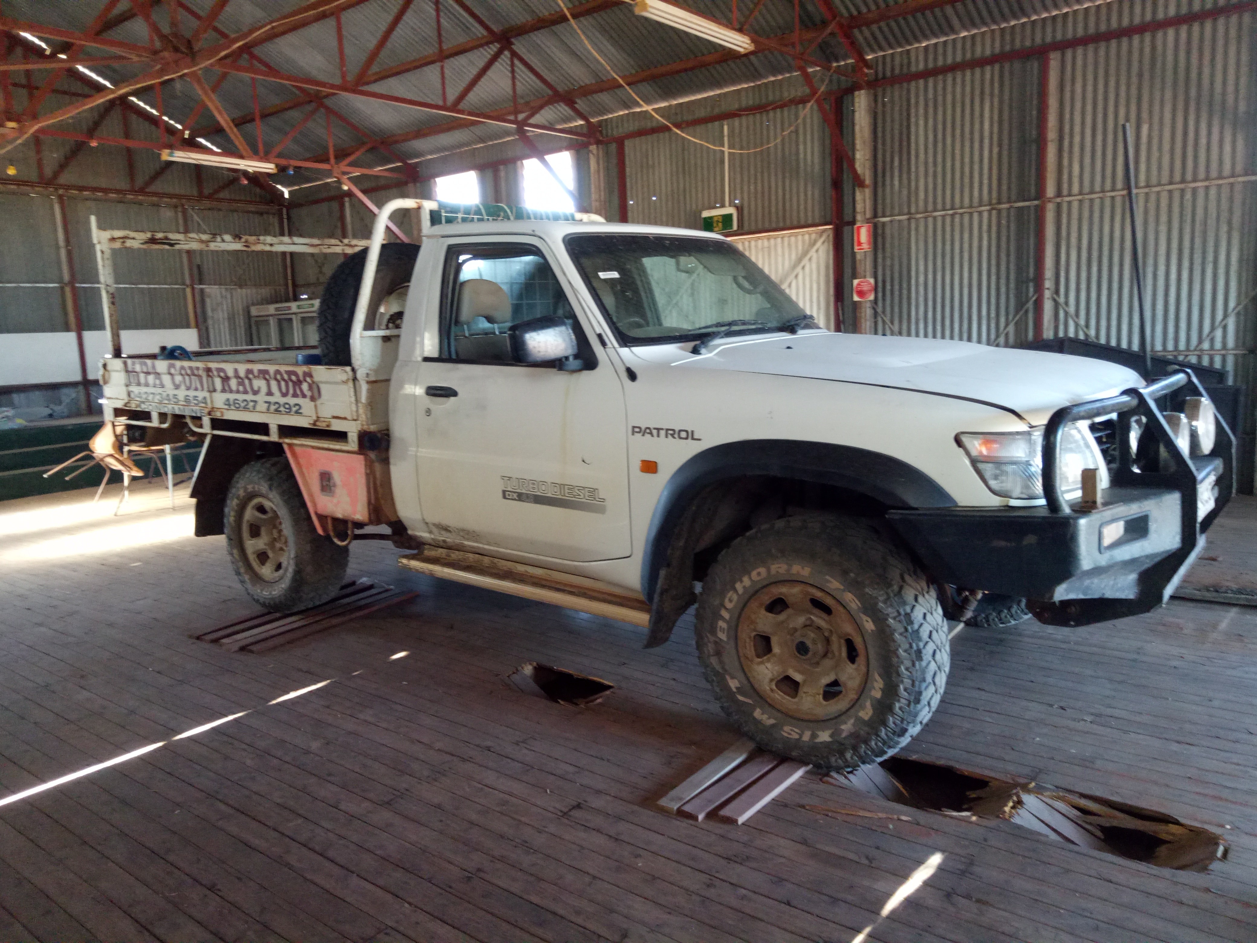
- The finished product. Phew!
Peter’s was quietly grateful. I let him buy me a lemonade before I bid him and his dog Cappy farewell. I jumped in my 4WD with a sore back, splinters in my hands and a big, tired smile. He offered me a room at the pub for the night but I was keen to continue my adventure.
No doubt for the next week he told the story about the smart, bossy, middle-aged woman who came out of nowhere to help him and his 4WD out of all sorts of bother.
Heading south
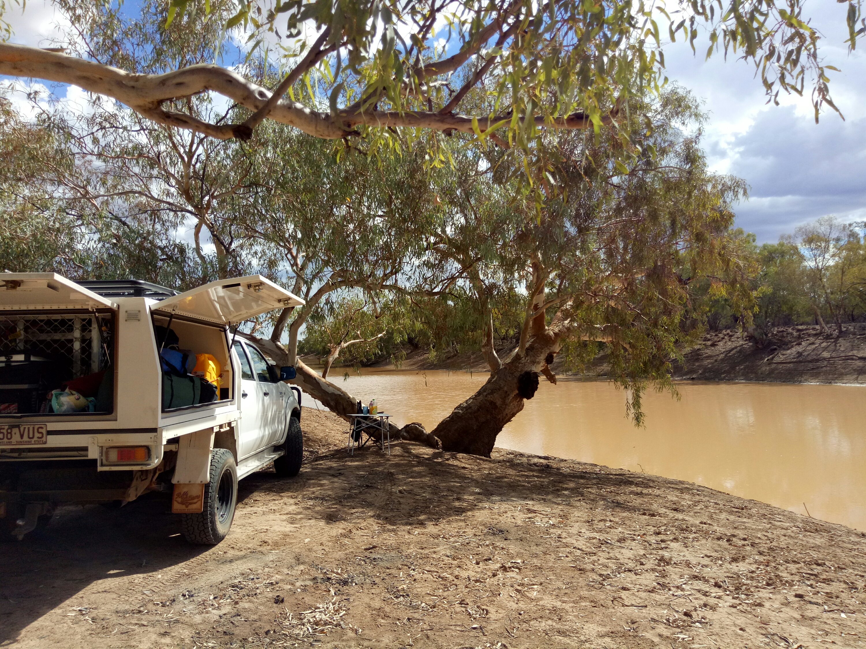
From Fords Bridge I headed south of Bourke and camped at the Yanda campground at Gunabooka National Park. There was no-one else there. Bliss. The next day I continued to follow the Darling River and camped at Neila Gaari Station, 90km from Wilcannia. I can highly recommend this place for a stunning place to camp.

- My campsite on the Darling River at Neila Gaari Station.
From there I stayed at Pooncarrie at another gem of a campsite on the Darling River. (Great pub in Pooncarrie with a young publican called Josh). I met three couples there and told them my story about Peter at Fords Bridge. They were excited to pop in and say hi to him on their travels north.
Kangaroo company and an extraordinary national park
I can’t understand why I’d never heard of heritage listed Mungo National Park. It’s rich in aboriginal history and is home to a beautiful shearing shed built in 1869.


I was there on March 1 so it was still very hot. I got a hell of a fright when i heard something at the back of my great campsite in the ‘main camp’ campsite. Kangaroos were drinking from my washing up bucket! Several little wallaby and kangaroo families came to drink from the bucket which I refilled countless times for the next few hours. Each would drink for about twenty minutes! While I never feed wildlife, I didn’t see a problem giving these guys water.

- What’s that Skip? You’re thirsty?
After a night of listening to wallabies drink I packed up and ventured on my to Adelaide where I worked for a week and then continued to my trip west.
Putting the Hilux in low range at Coffin Bay: my second favourite day of 2018
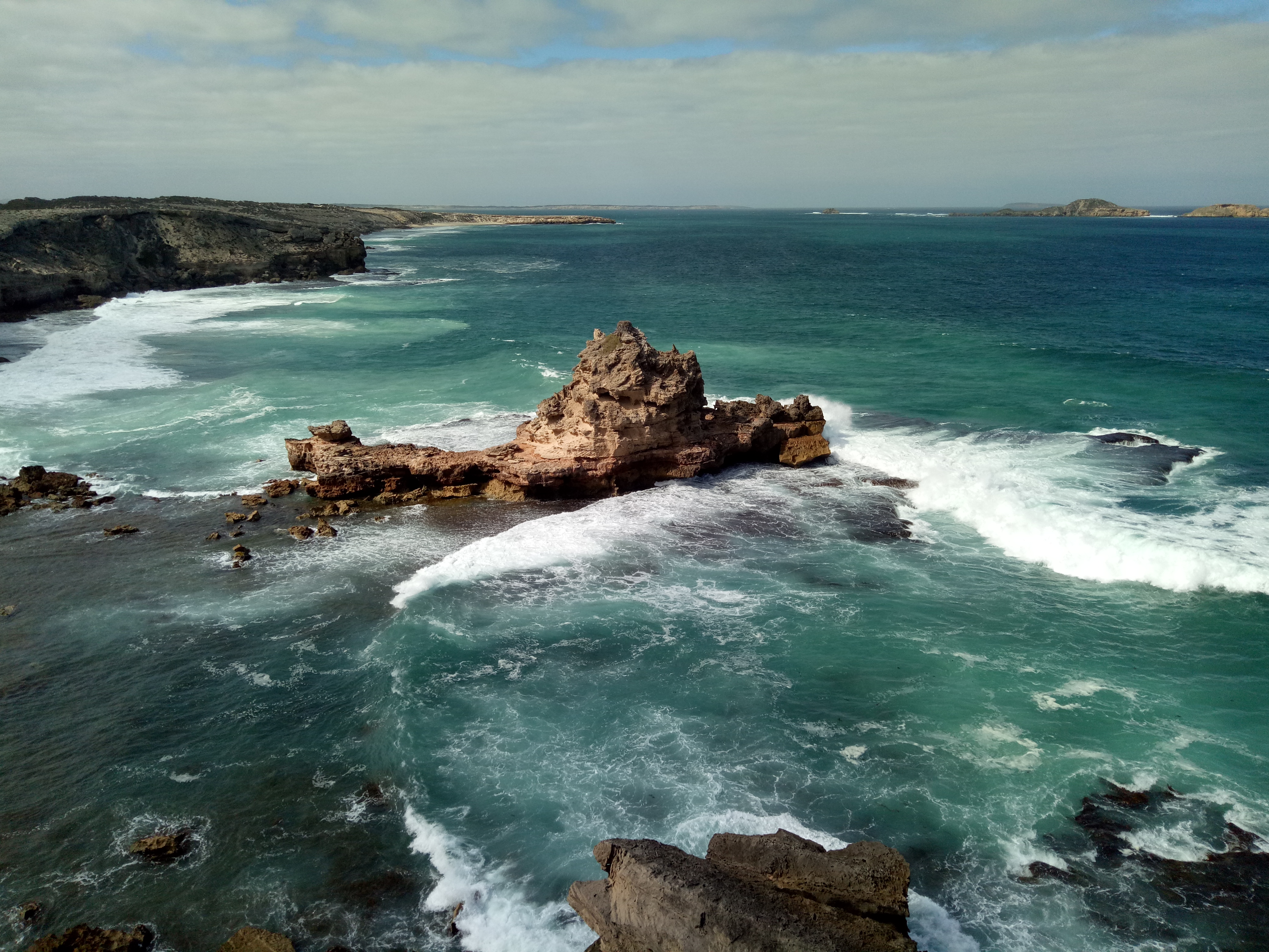
South Australia’s Eyre Peninsula is one of Australia’s best kept secrets – lovely seaside towns and camping opportunities everywhere. At the southern extremity of the Peninsula is the glorious Coffin Bay National Park. The first campground is accessible via sealed road but getting deep into the park requires sand and beach driving.
I hadn’t had much experience on sand so I was nervous, almost to the point of not going into the park. But I was well-prepared, I have a personal locator beacon, I have a UHF radio and knew the rangers were contactable that way (there’s no phone coverage there), a friend knew where I was going, I have all the equipment needed for a recovery, I know how to put my tyre pressure up and down, and I know all the theory about sand driving. It was time for the preparation to meet opportunity. And what an opportunity! The place is magnificent.
- Coffin Bay National Park on the Eyre Peninsula is magnificent.
The driving was fine and AWESOME FUN. I used my gears effectively and didn’t come close to getting bogged. I felt in control at all times. On one of the narrow tracks a ranger in his 4WD gave way for me. We stopped and chatted about conditions further up the track (ALWAYS talk to a ranger when you see one. Local knowledge, stories, tips and advice are invaluable). “You’ve got this far, you’ll be fine!” he smiled. And he nodded approvingly when I told him I’d dropped my tyres down to 13PSI. (I’d passed a bunch of P-platers who hadn’t put their tyres down and were having great fun trying to get through the sandy tracks. When you’re young and silly you can take those risks, I guess.)


At no stage did the ranger say “oh, you’re on your own?” which is something I’ve grown very tired of. Women tell me I’m brave, some women tell me how lonely I must be (they’re usually the ones who have husbands who do everything for them), and men assume I’m running away from something and take the opportunity to invade my campsite unannounced to ‘see that I’m ok’ and invite me to sleep in their caravan. (Boy, that future blog’s going to be a doozy!)
Nullarbor bound and a camel and poddy calf friendship
While there are a few places to stop and look at the amazing Great Australian Bight, the Eyre highway across the Nullarbor itself is pretty uneventful.
- Nullarbor views aren’t too shabby.
There are lots of places to bush camp on the Nullarbor, and my new friends Mr Squiggle and Bozo offered a nice reprieve at Fraser Range Station, a great place to spend the night at the western end of the Nullarbor.

- Best friends: Mr Squiggles and Bozo
The camel was orphaned when he was one week old, and the calf was abandoned by his mum. I stayed at Fraser Range in mid-March and these guys had spent the previous eight months as best friends, united at one week of age.
WA’s goldfields: a 4WD explorer’s delight
What a surprise the Goldfields are! Rich in pioneering history, brilliant 4WD tracks and camping opportunities, and a plethora of fascinating cemeteries that tell stories of incredibly hard yet interesting times, you should definitely put the Goldfields on your bucket list.
There are these sorts of tracks all over the Goldfields. Make sure you have a good map and lots of water. It’s not hard to work out why many gold miners perished here. This country is not forgiving.
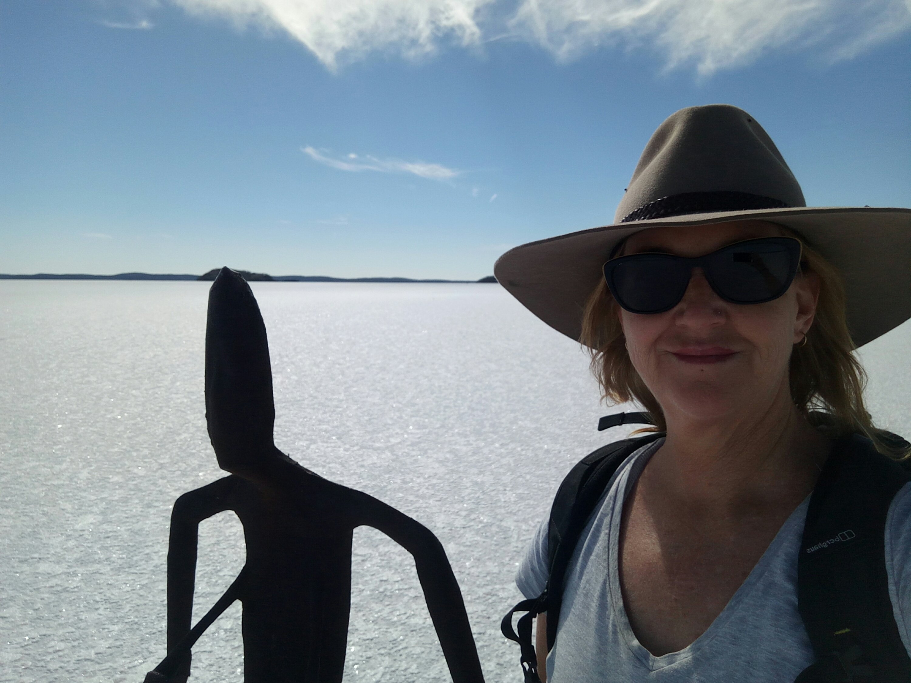
The salt lake at Menzies, north of Kalgoorlie, and the art installation there has to be seen to be believed. Again, I’d never heard of Lake Ballard until I wandered into the Menzies pub.
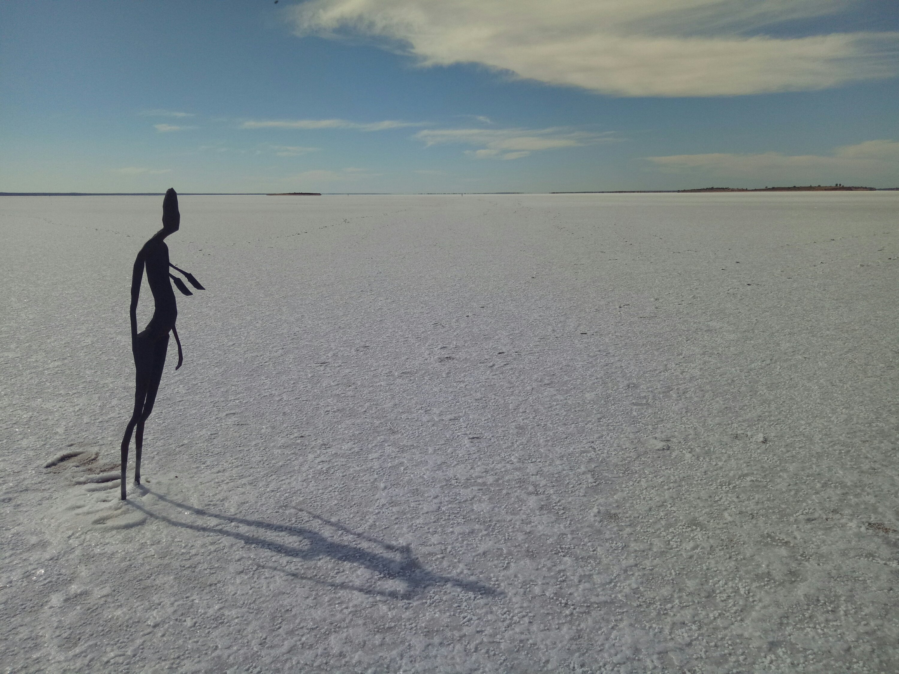
- Lake Ballard near Menzies.
And the Goldfields sunsets are hard to beat…
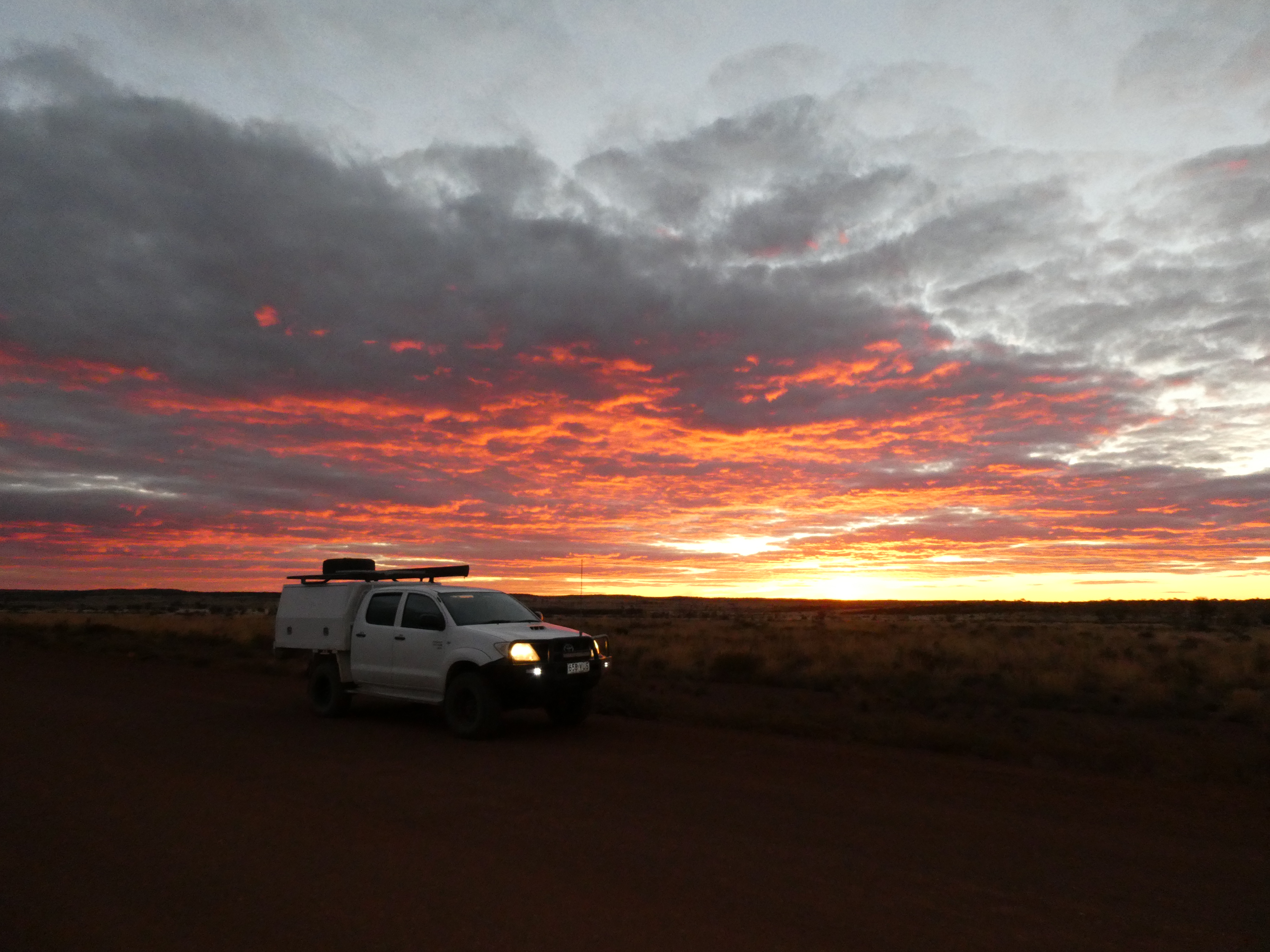
- Taken near Warburton, WA
NEXT STOP: Birdsville!
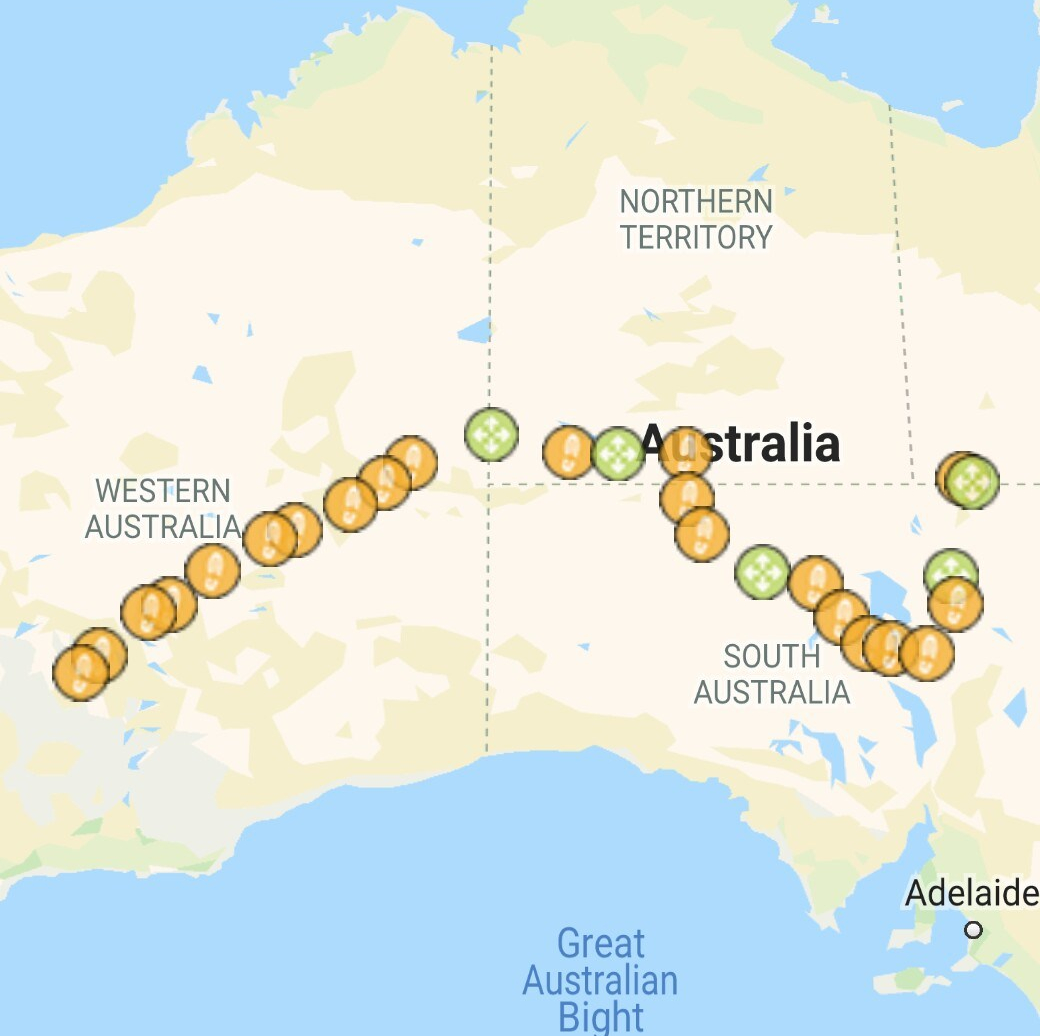
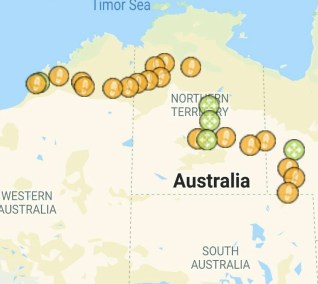
- My route from Kalgoorlie to Birdsville
After working in Kalgoorlie and exploring the Goldfields for four months I was Birdsville bound for a great three-day concert in the Simpson desert called the Big Red Bash.
By now it was winter (June 20) so the nights neared zero in many places. I now slept in a tent because of the extra warmth it offered. I took two weeks to get to Birdsville via Uluru and the Oodnadatta and the Birdsville Tracks.
There was so many highlights on this 3,000 kilometre trek which was predominantly on dirt roads. Particularly memorable moments were the lovely grey nomads who drank me under the table somewhere on the Oodnadatta track, the wonderfully welcoming people of Maree (South Australia), camping under a full moon over Lake Eyre and the horses running through my camp at sunrise on the outskirts of Kaltukatjara (Docker River, just over the NT border).
Two bloody big surprises
Why have I never heard of the Painted Desert? I didn’t know what to expect and I was blown away by what I saw. 90km south west of Oodnadatta, this incredible landscape is on private property, Ackaringa cattle station. Click on the link to see photos. My own pics don’t do it justice. The homestead offers great camping. And the view’s not bad either.
- Camping at Ackaringa Station.
And then there was this fella! North of Maree on the Birdsville Track I saw an ostrich! I posted the pictures online and did half a dozen radio interviews about what I’d seen. It even inspired a really interesting ABC News story. Read it here and watch my video. Ha – you’ll hear my amazement!
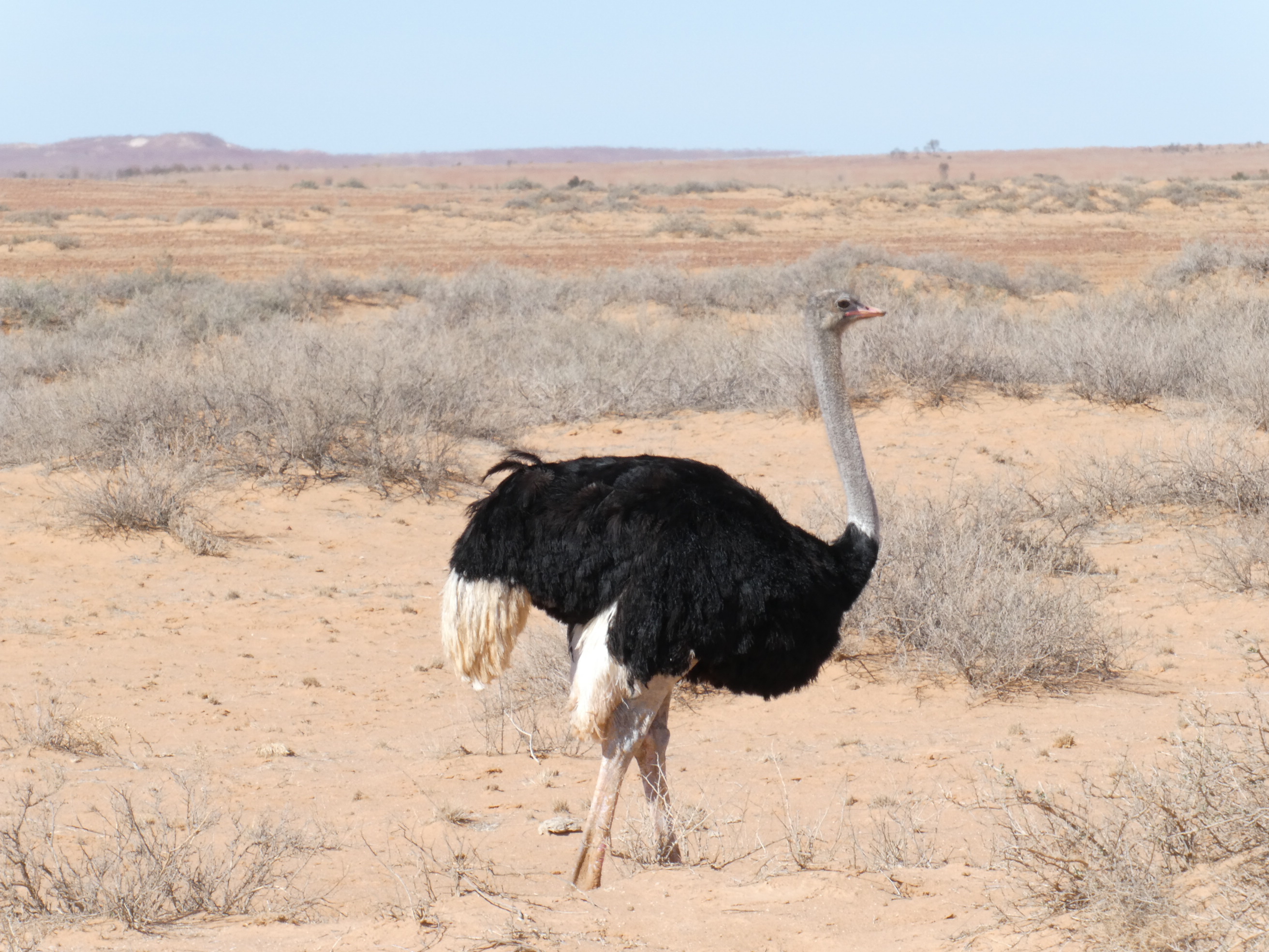
- This male ostrich was on the Birdsville track. I’ve never done a U-turn so quick in my life!
The Big Red Bash
Nine-thousand people made their way to Australia’s best live music event. (Big call, I know.) It’s called the Big Red Bash and it’s held annually on an organic cattle station west of Birdsville with the famous Big Red sand dune in the background. I met my friends Rob and Paula there and we had a ball dancing and singing to the likes of John Farnham, the HoodooGurus, Kate Ceberano, Busby Marou and Travis Collins.


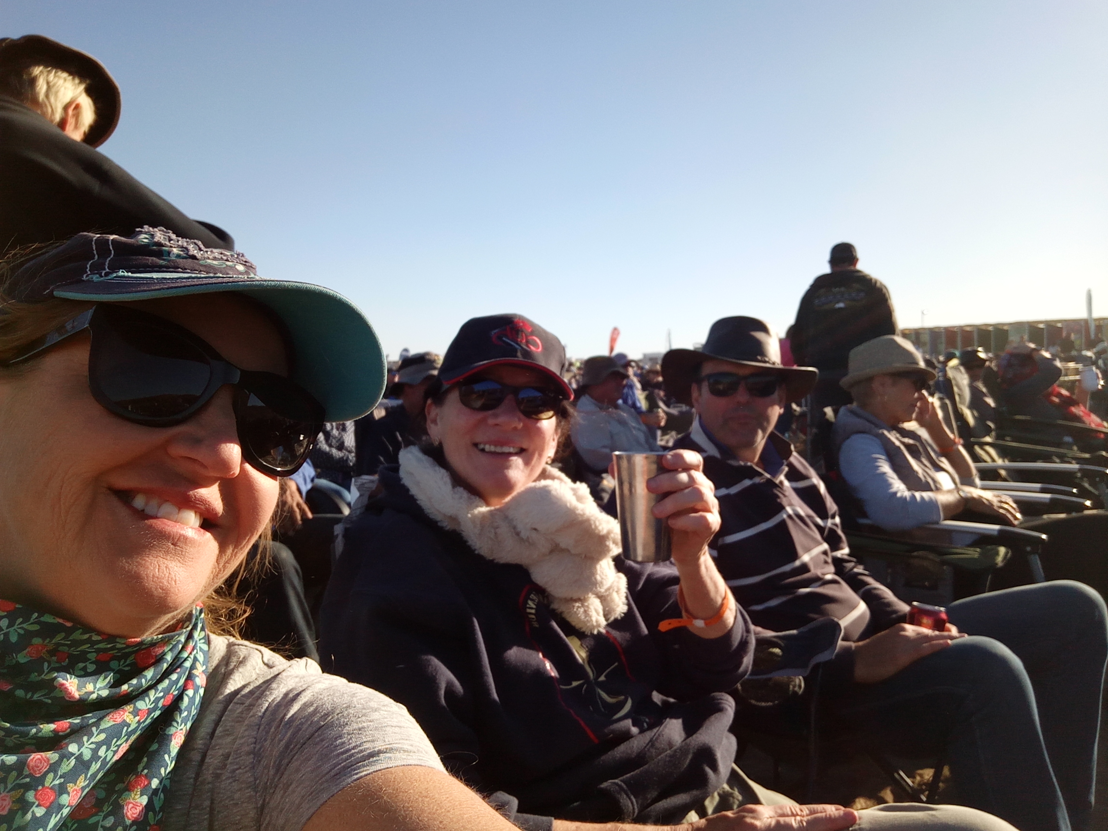
- My friends Paula and Rob travelled from Sydney to meet me at the Big Red Bash. Cheers!
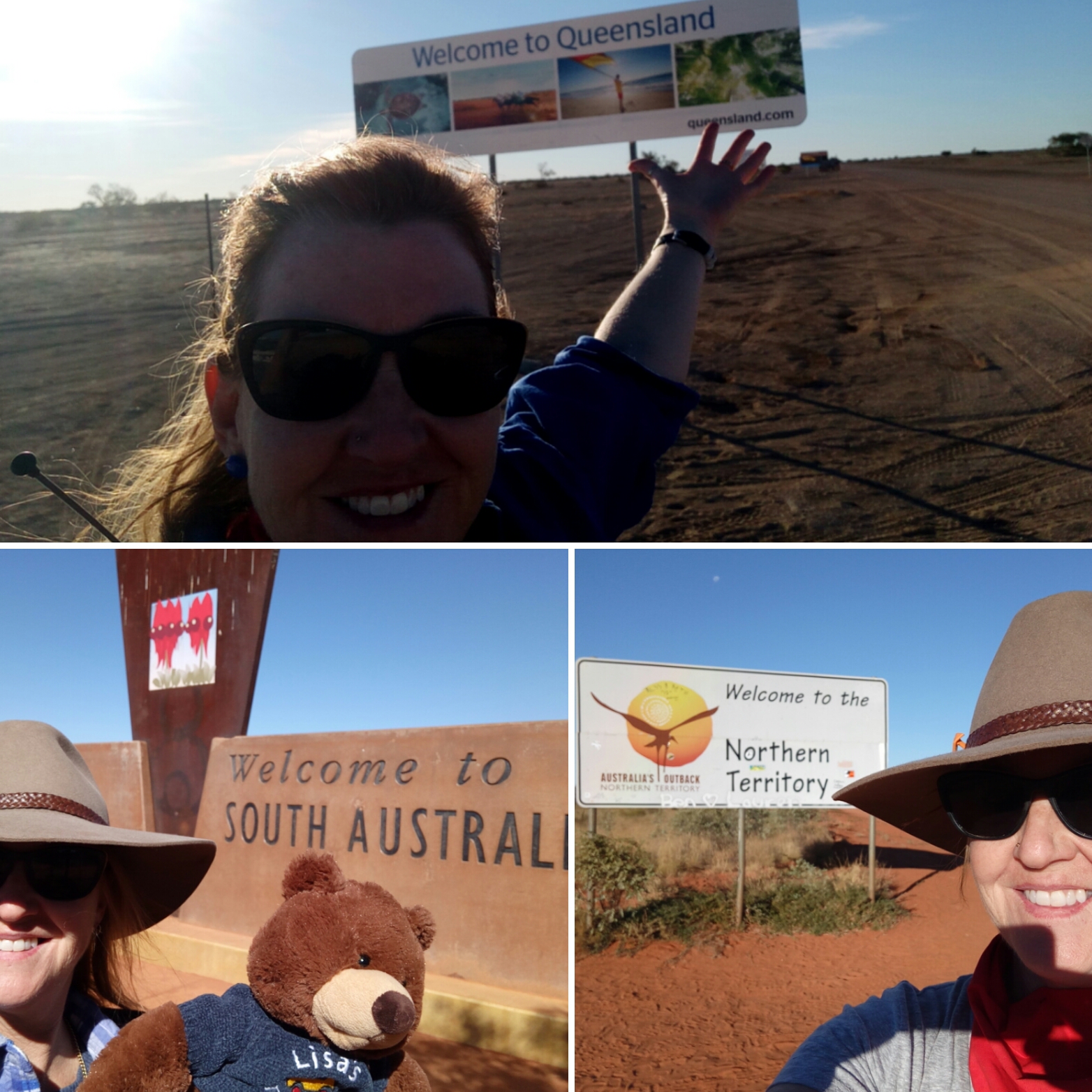
- I’d crossed three state lines to get from Kalgoorlie to Birdsville for the Big Red Bash.
My pet hate: caravanners who don’t know how to use their UHF.
I had a few weeks to drive from Birdsville to the Broome where I had a few months work. By this stage it was mid-July which is peak grey nomad time. Because I’m not towing a trailer or caravan I’m quicker than they are so I try to avoid them as much as I can.
You see, my pet hate is vehicles on dirt roads who don’t use their UHF radio how it should be. Yes, if you’re travelling through regional Australia you should have a UHF and you should have it on and scanning at all times. If you’re scanning, people like me can contact you and let you know that I’m planning to overtake you or ask you what you can see ahead. SO many travellers keep their UHF on one channel which means, unless I know what channel you’re on, I can’t communicate with you. Ha – and I wish you could hear what the truck drivers and road workers are saying about you when you piss them off by not being contactable.
Keeping in touch
I avoid caravanners as much as I can by taking the road less travelled. In fact, the roads are actually tracks and it means I go pretty remote and often don’t see anyone for days. Bliss! It also means I have to be self-sufficient. I have a GPS tacking device that allows me to send a daily message to a few friends letting them know I’m out of range but okay. If I don’t send that daily message they’re able to look at my last location via my tracking website and alert the nearest police station. I carry enough food and water for at least a week, plus I carry extra fuel.
From Birdsville to the Kimberley
- My GPS tracker reveals my Birdsville to Broome route
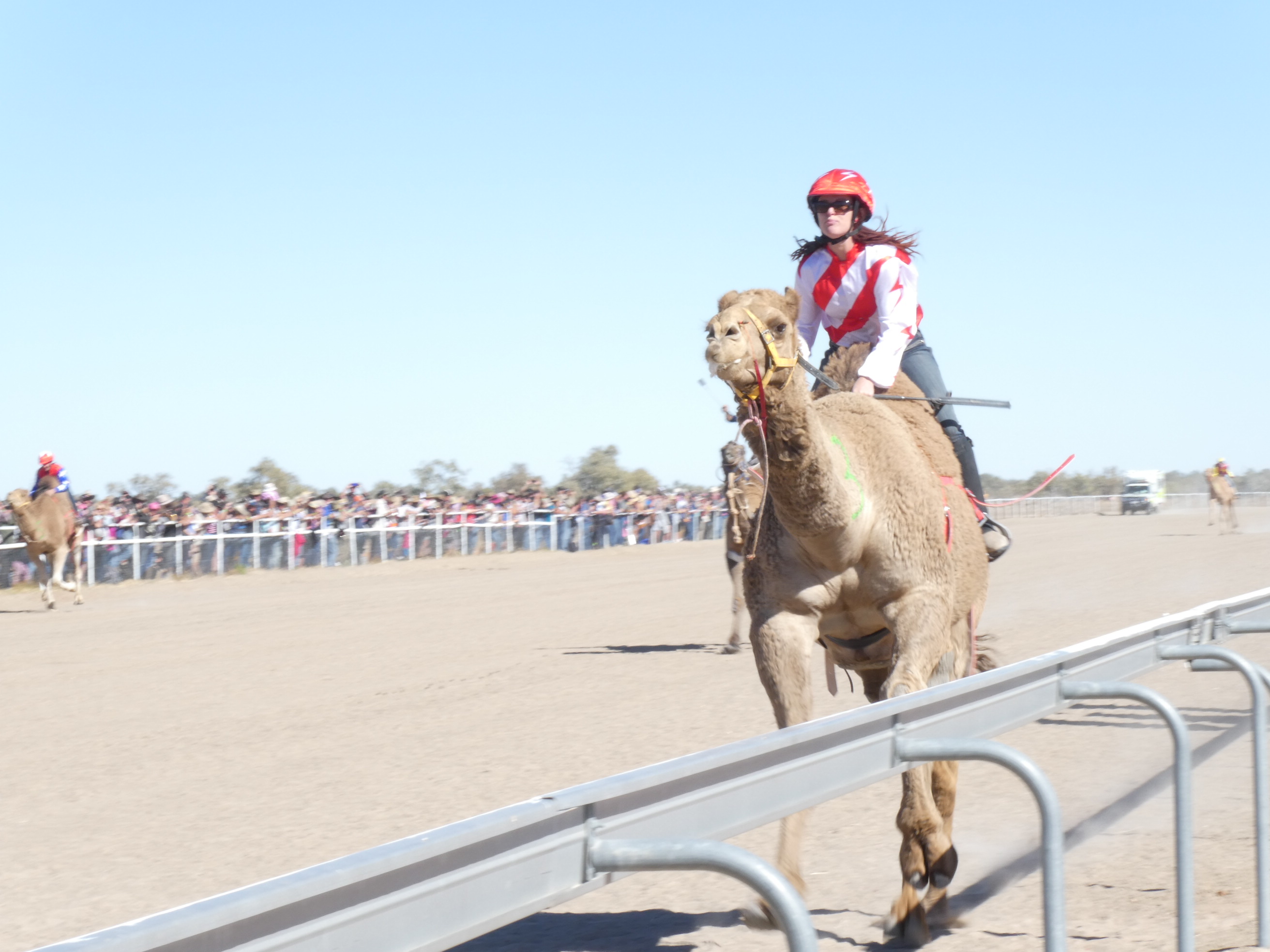
From Birdsville I headed to Bedourie for the annual camel races. Such a fun day!
Then it was up to Boulia and then left into the guts of Australia!
The Donohue Highway turns into the Plenty Highway at the Northern Territory border and its condition leaves a lot of be desired. But it’s a good drive if you take it easy and don’t mind lots of shakes and bumps. Not all vehicles can handle these rough outback roads though.


I got off the highway and turned onto a track called Binns Track. I’d planned to head north until I hit the Sandover Highway.
Travelling on these tracks you see the real outback and no people. Below are photos of my refueling stop (for me as well as the Hilux). I was carrying 60 litres of diesel in jerry cans.


I kept travelling north, got onto the Sandover highway which was very rough and eventually headed north on a track yet again, passing through two cattle stations before popping out near Ti Tree on the Northern Territory’s Stuart Highway. I love having cattle company.
The beer economy
It was a treat to be back on bitumen for a while. I was to head north on bitumen for about 750 kilometres before hitting the dirt west towards Top Springs and then continuing west to the WA border.
But first I needed to give the Hilux some care. I had snapped one of six bolts holding my tray on and the remaining ones were loose. Eek. Tennant Creek was chockers with travellers and I was sure that there was going to be a long line of vehicles needing attention by the town’s mechanics. But I stumbled across a brilliant and friendly mechanic who I offered to pay in beer. He smiles and says “see you in 40 minutes” and with that the deal was done and my car was ready within an hour.
The Northern Territory is well-known for having a beer economy and I can vouch for its effectiveness!
On the road again
I camped in Tennant Creek the night and headed north for another 400km on bitumen. I turned left north of Newcastle Waters and started the stretch west to the WA border, camping at Top Springs pub, and staying at Humbert River cattle station which the local cop had arranged for me. (Always talk to country cops as well as park rangers!)
I drove through Gregory National Park which was amazing but very rough on my tyres. There’s no way I’d drive in that park without a second spare tyre. It was slow going and I needed low range a couple of times. FUN! I took the Wickham and Gibbie tracks, camping at Fish Hole Yards where there’s a gorgeous creek.
Made it to the west!
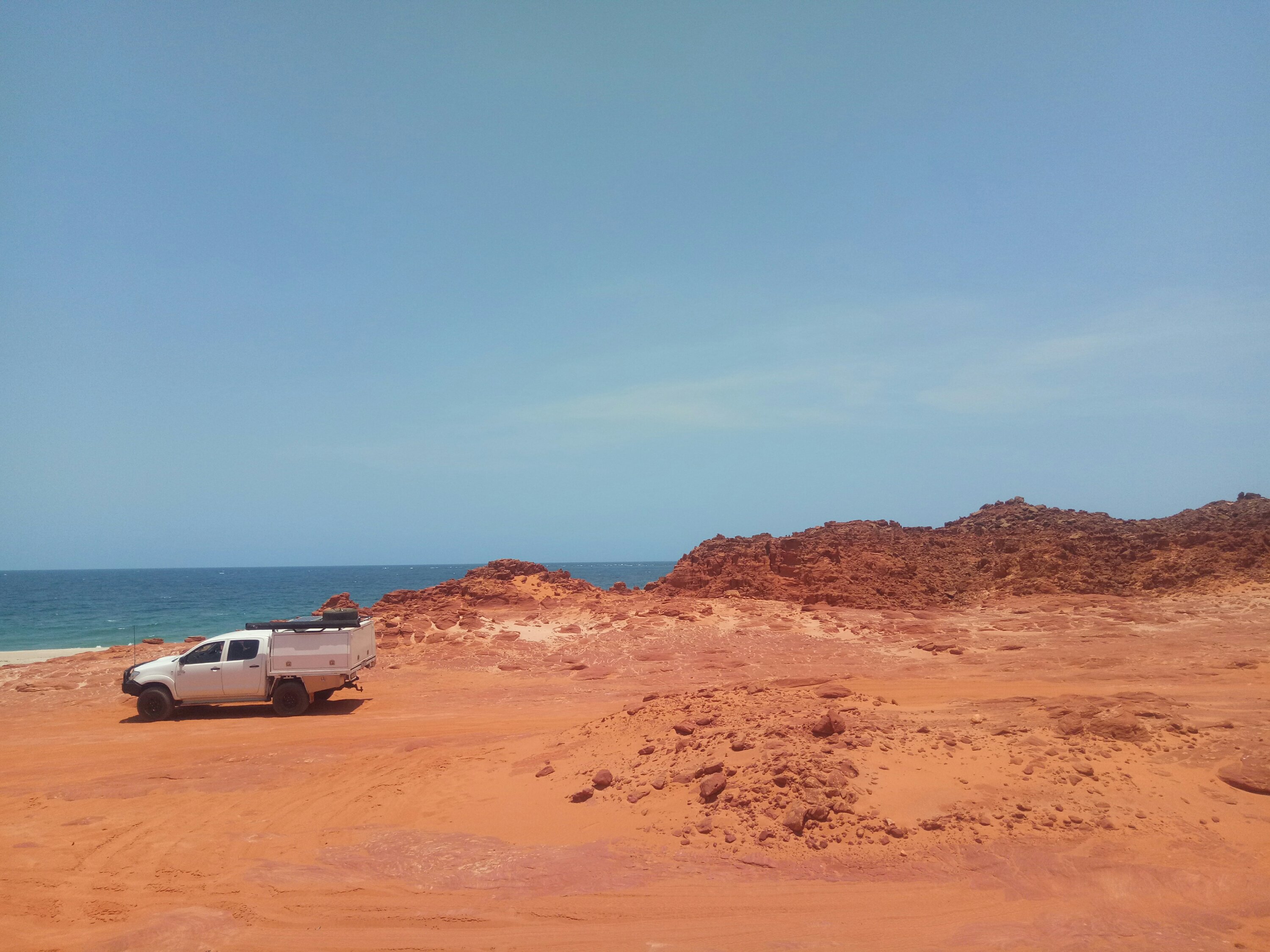
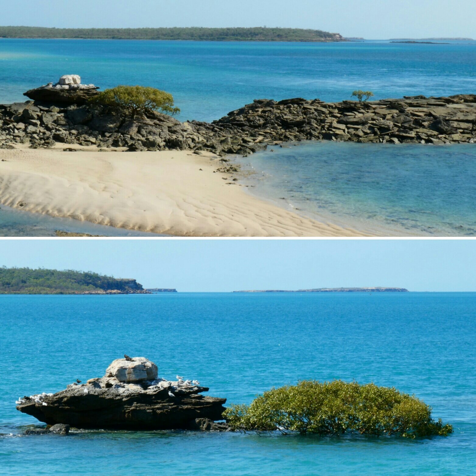
I had one last remote camp site in the NT, this time by the side on the Buntine Highway, near the WA border. Then HELLO KIMBERLEY! Halls Creek, the Wolf Creek crater, Fitzroy Crossing, Tunnel Creek, Windjana George (flat tyre), Derby and finally Broome.
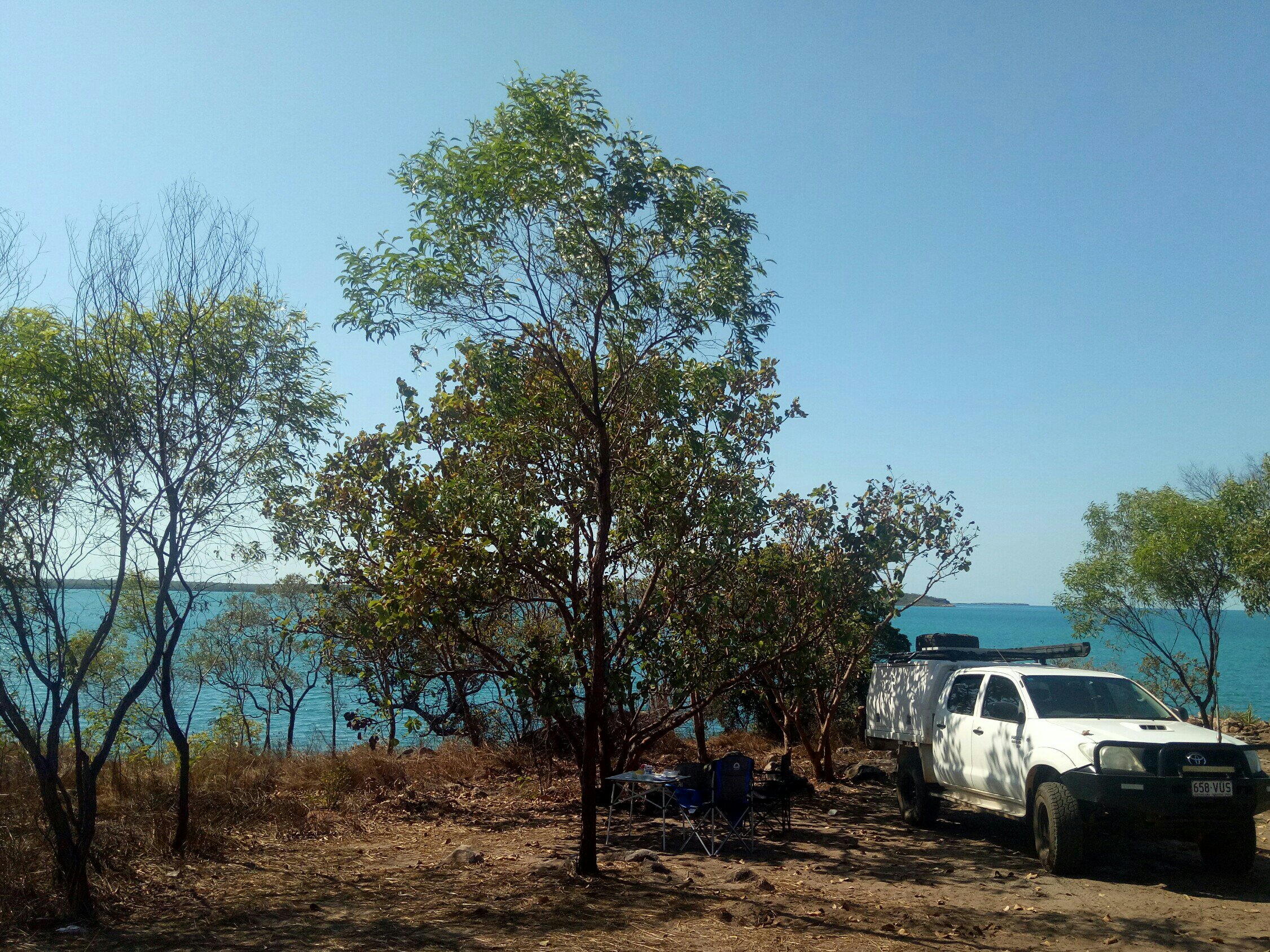
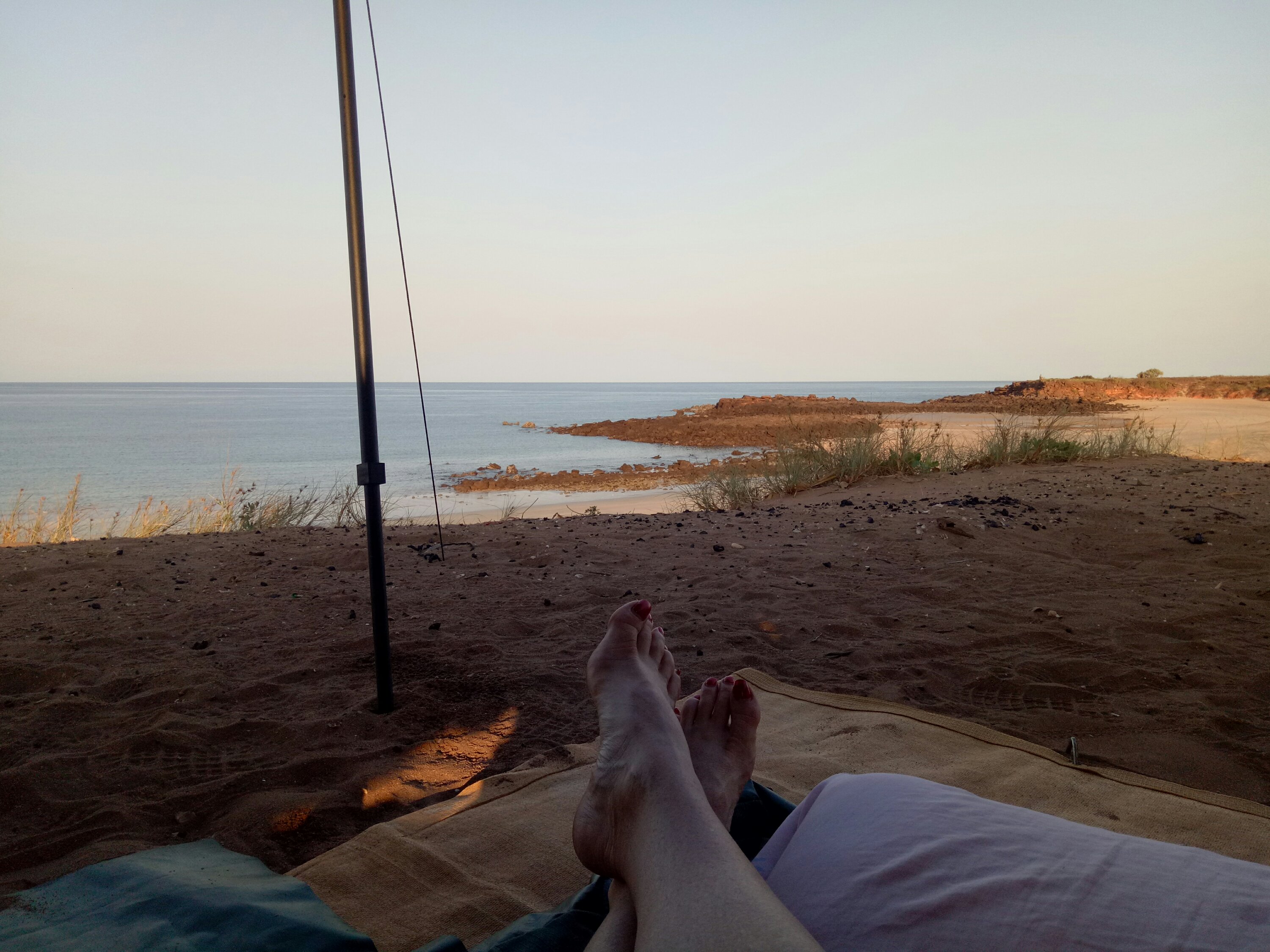
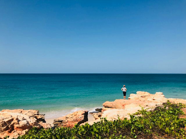
The best of Broome.
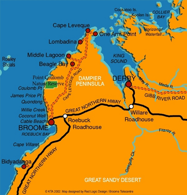
I started work in Broome in early August and finished my contract in mid-December. Most weekends I was able to explore the Dampier Peninsula. (I’ve already blogged about that here)
I really enjoyed seeing Broome at its busiest during the dry season and at its quietest from October when it really heats up and the tourists (and some residents) head south.
So much more.
This is just a glimpse of ten months on the road. I’m currently in Darwin and will head east in the new year. I’ve challenged myself, surprised myself, learned lots, seen incredible wildlife and landscapes, met some brilliant people and had lots of fun. Let the adventures continue!
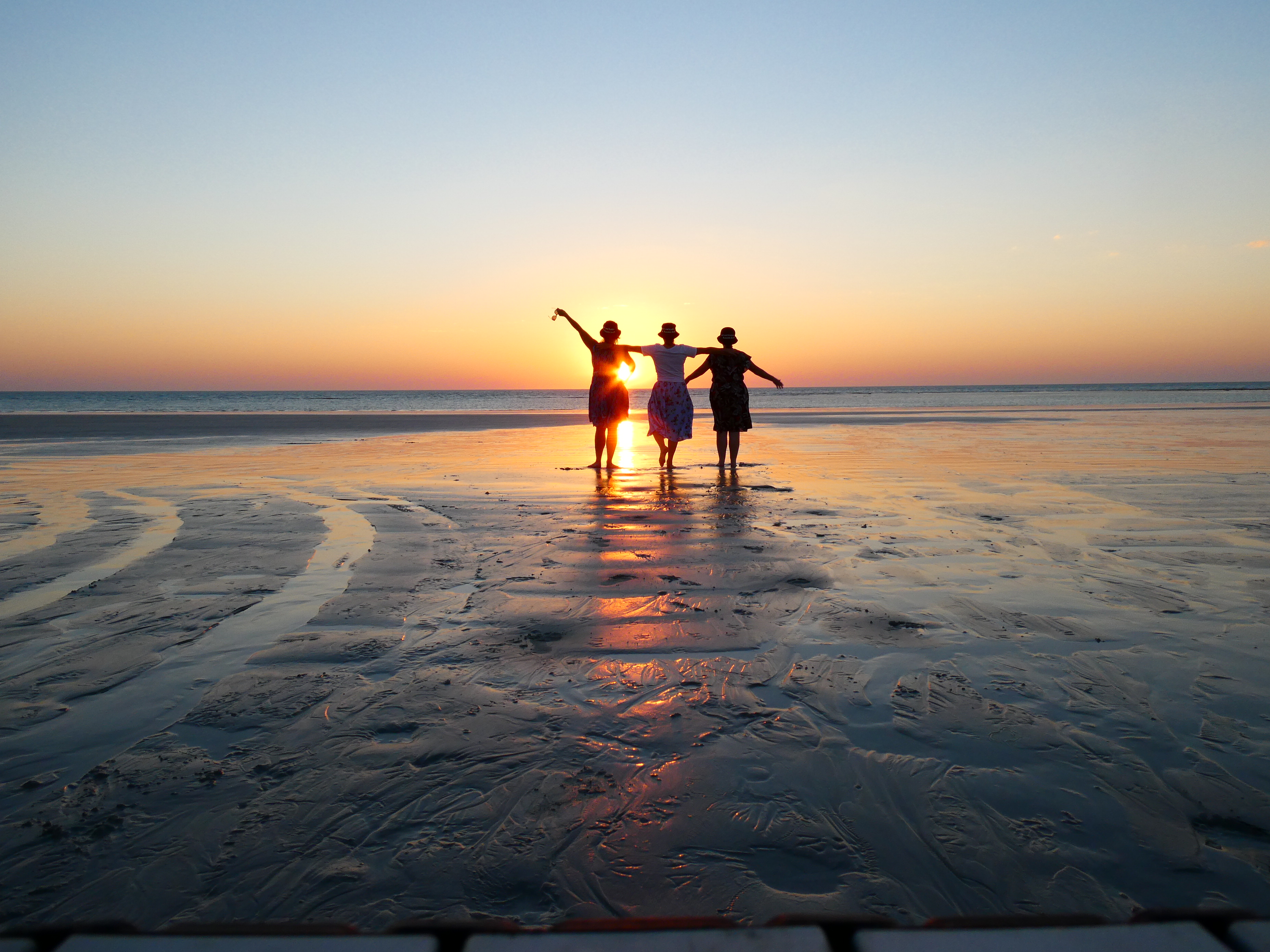
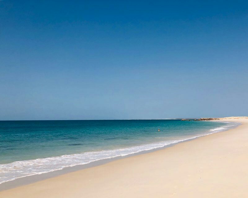
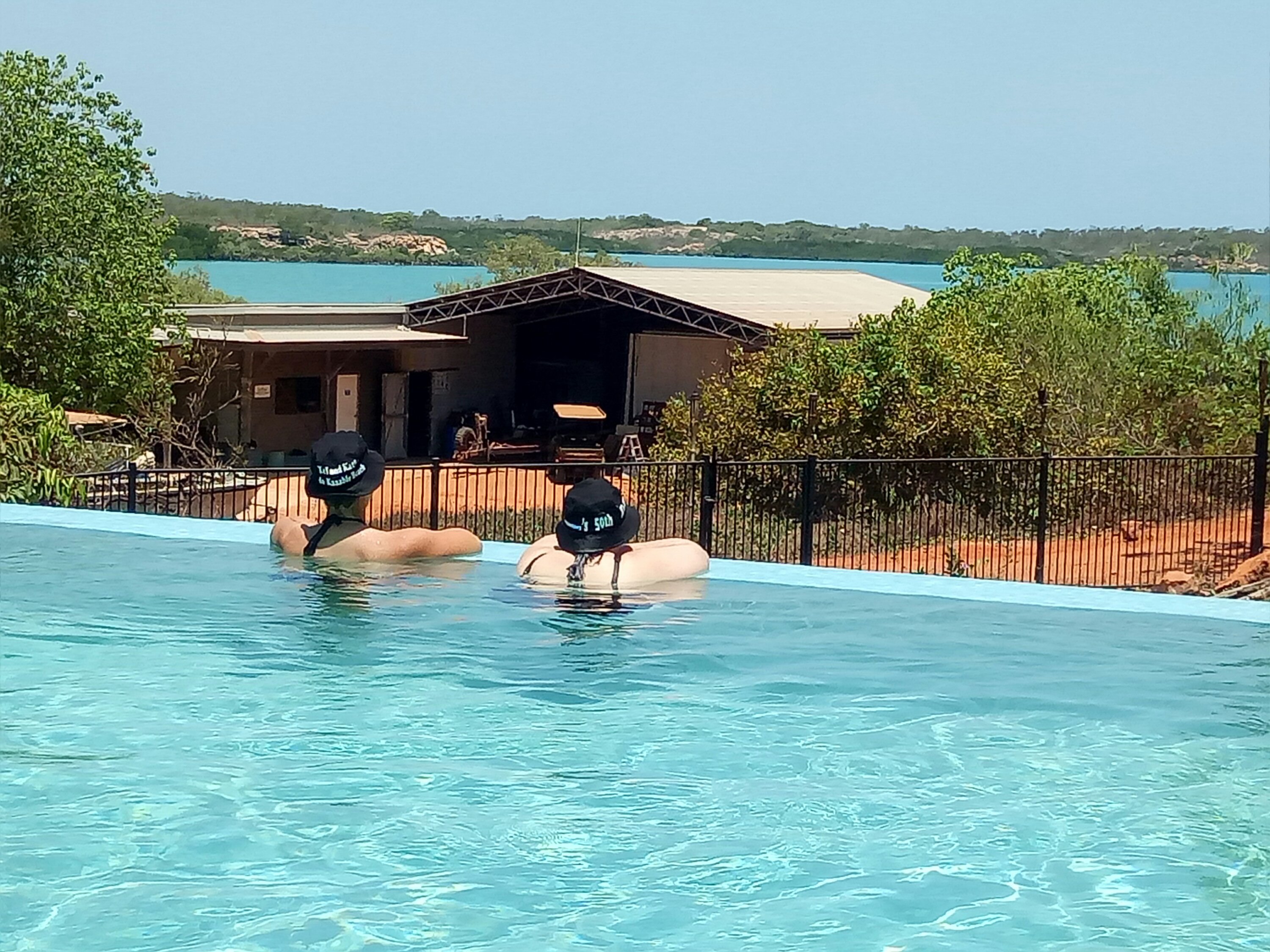
- My birthday celebrations on Cable Beach – Sept 29, 2018.
ABOUT THE BLOGGER:
Lisa Herbert is houseless not homeless. She’s the author of funeral planning guide ‘The Bottom Drawer Book: an after death action plan’ . She’s been travelling around the country for about four years, occasionally filling short-term contracts for the ABC in places like Kalgoorlie, Broome, Tamworth and Darwin. Lisa enjoys blogging about the unusual graves, memorials and cemeteries she finds on her travels.
Get in touch with Lisa via Facebook.